The best sandbar near you — and when to go.
On the water and looking for a sandbar to anchor, wade or hang out on? Tap once. Sandbar Scout checks the public maps, charts and aerial photos around you, reads what locals say, and picks the best spots — with the best time to go and what to watch for.
A short list you can act on from the boat.
- The best few spots, best first — each with its aerial photo and the spot marked.
- The best window today or tomorrow, from tide predictions and daylight.
- Who it suits — party, family, quiet or fishing — and whether a boat, pontoon, kayak or wading works.
- What to watch for: channels and wakes, rising tide, current at inlets, storms, rip currents.
- One tap for directions in Google or Apple Maps, or save the spot to My Field.
- Spots locals mention that no map places are listed separately — never given a made-up pin.
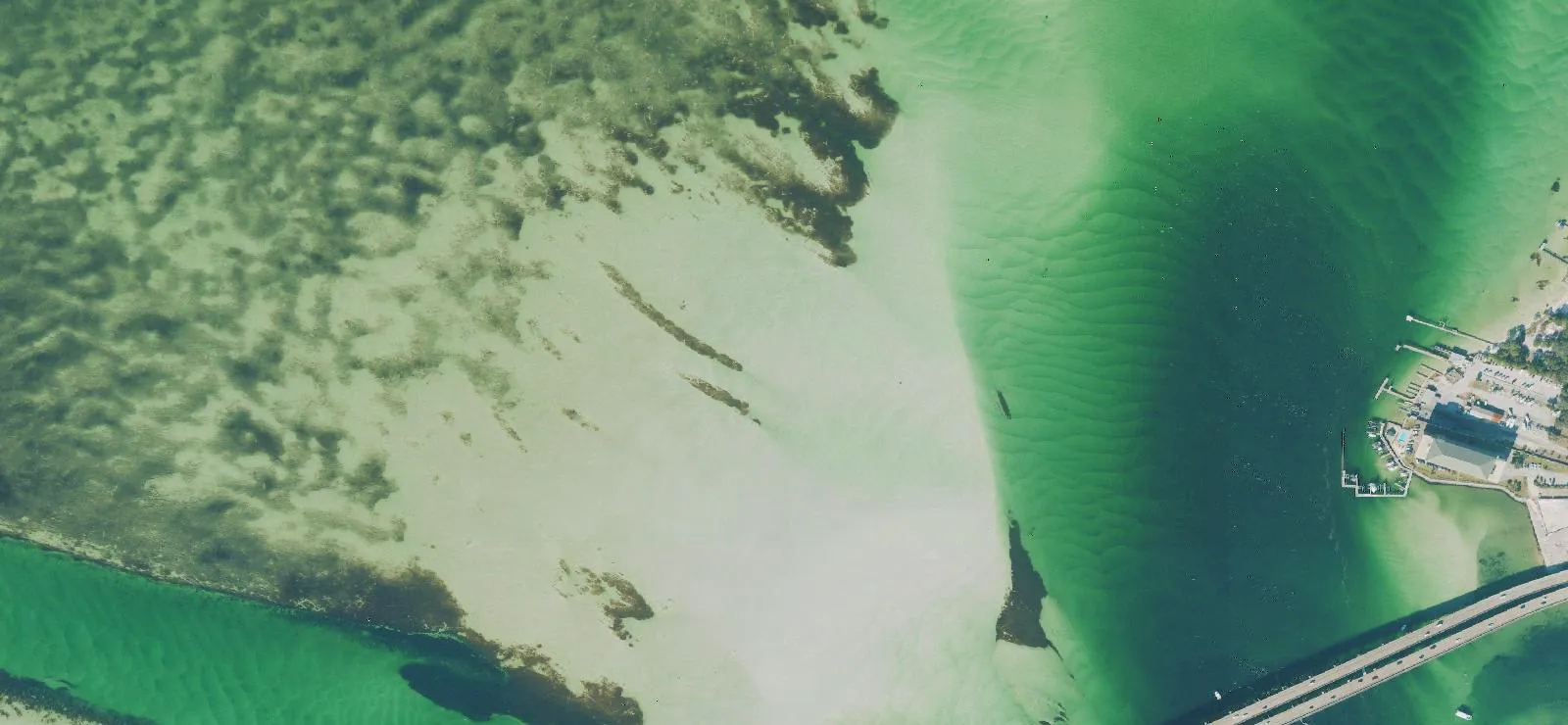 USDA aerial photo · public domainExample
A wide, shallow sand flat inside East Pass — the area’s classic party sandbar.
Six public sources, checked in about a minute.
Where two sources agree and the photo shows sand, you get a strong match. Locations come from the maps and the photo itself — never from the AI’s imagination.
Public maps
Sandbars, shoals, sandy islets and beaches mapped on OpenStreetMap — including many local hangouts.
NOAA charts
Depth areas from NOAA nautical charts: shallows that dry at low tide, and the dredged channels to stay clear of.
Official place names
USGS names for bars, flats and beaches — the ones on the government’s own maps.
Aerial photos
Public-domain USDA aerial photos (about 2 ft per pixel). The AI looks for pale sand next to deeper water — even small lake and river bars no map shows.
Local reports
A short web search of blogs, forums, marinas and news for what locals say: crowds, vibe, access, closures. Every claim links to its page.
Live conditions
NOAA tide predictions, the National Weather Service forecast and alerts, and rip-current risk at nearby beaches.
Tap “Find sandbars near me” — or type a lake, beach, town or ZIP.
Pick how far (5, 10 or 20 miles), how you’re getting there, and the vibe, or leave the defaults.
It checks the maps, charts and photos around you.
Then, if you allow it, the AI looks at the photos and a short web search of local reports.
You get the best spots, the best time and the watch-outs.
Tap Directions, save the spot, or share it with your crew.
Private
Your exact position never leaves your phone. Searches use a rough area (about 1 km) and are saved only to your account — delete them anytime.
Bounded
A maps-only search is free. The full scout shows its maximum (up to 25 credits, $0.25) before it runs, and you pay only for what ran.
Honest
Photo dates are shown, charts are “not for navigation”, and anything unconfirmed is labeled. No invented depths, crowds or rules.
Sandbar Scout FAQ
Does it work on lakes and rivers, not just the ocean?
Yes. On a lake or river there are no tides — the water level decides how much of a bar is out — so the aerial photo check matters most there. Bars as small as a boat or two wide can show up in the photos even when no map has them.
Do I have to share my location?
Only if you want “near me”. Your phone’s exact position never leaves it: the app rounds it to about 1 km before searching and works out exact distances on the phone. Or just type a lake, beach, town or ZIP.
Do you use Google Maps?
We open Google Maps or Apple Maps for directions to the spot you pick. The AI itself looks at public-domain USDA aerial photos and government charts — not Google’s imagery, which its terms don’t allow us to analyze.
How current are the photos and charts?
USDA flies each state every two to three years, and the photo date is shown on every pick. Sandbars move after storms and floods, so treat a pick as a strong lead, then look before you anchor.
What does it cost?
A maps-only search is free. The full scout — AI photo check and local reports — shows its maximum first (up to 25 credits) and you pay only for what ran. If nothing turns up, or the AI step doesn’t finish, nothing is charged.
What if I lose signal on the water?
The search keeps running on our side and is saved to your account, so it’s waiting when your signal comes back. Saved spots and recent searches reopen from the app.
Is it safe to anchor where it says?
Use it as a starting point, not for navigation. Idle in slowly and watch your depth, check the tide, stay clear of marked channels, obey posted rules and bird-nesting closures, and leave at the first thunder.
Where does it work?
U.S. waters — the maps, charts, photos and forecasts it uses are U.S. public data.